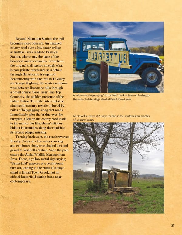
Beyond Mountain Station, the trail becomes more obscure. An unpaved county road over a low water bridge at Buffalo Creek leads to Pusley’s Station, where only the base of the historical marker remains. From here, the original trail passes through what is now private ranchland, so a detour through Hartshorne is required. Reconnecting with the trail in Ti Valley via Savage Highway, the route continues west between limestone hills through a broad prairie. Soon, near Pine Top Cemetery, the sudden presence of the A yellow metal sign saying “Bu琀琀er昀椀eld” marks a turn-o昀昀 leading to Indian Nation Turnpike interrupts the the ruins of a later stage stand at Bread Town Creek. nineteenth-century reverie induced by miles of lollygagging along dirt roads. Immediately after the bridge over the An old well survives at Pusley’s Station, in the southwestern reaches turnpike, a left on the county road leads of Latimer County. to the marker for Blackburn’s Station, hidden in brambles along the roadside, its bronze plaque missing. Turning back west, the road traverses Brushy Creek at a low water crossing and continues along tree-shaded dirt and gravel to Waddell’s Station. Soon the path enters the Atoka Wildlife Management Area. There, a yellow metal sign saying “Butter昀椀eld” appears at a southbound turn-off, leading to the ruins of a stage stand at Bread Town Creek, not an of昀椀cial Butter昀椀eld station but a near- contemporary. 27
 July 2024 OHOF Magazine Page 28 Page 30