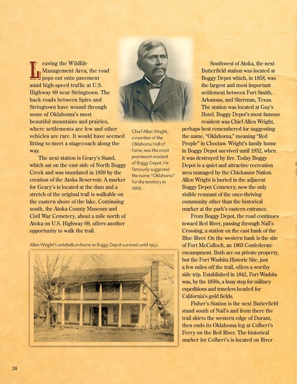
eaving the Wildlife Southwest of Atoka, the next LManagement Area, the road Butter昀椀eld station was located at pops out onto pavement Boggy Depot which, in 1858, was amid high-speed traf昀椀c at U.S. the largest and most important Highway 69 near Stringtown. The settlement between Fort Smith, back roads between Spiro and Arkansas, and Sherman, Texas. Stringtown have wound through The station was located at Guy’s some of Oklahoma’s most Hotel. Boggy Depot’s most famous beautiful mountains and prairies, resident was Chief Allen Wright, where settlements are few and other Chief Allen Wright, perhaps best remembered for suggesting vehicles are rare. It would have seemed a member of the the name, “Oklahoma,” meaning “Red 昀椀tting to meet a stagecoach along the Oklahoma Hall of People” in Choctaw. Wright’s family home way. Fame, was the most in Boggy Depot survived until 1952, when The next station is Geary’s Stand, prominent resident it was destroyed by 昀椀re. Today Boggy which sat on the east side of North Boggy of Boggy Depot. He Depot is a quiet and attractive recreation Creek and was inundated in 1959 by the famously suggested area managed by the Chickasaw Nation. creation of the Atoka Reservoir. A marker the name “Oklahoma” Allen Wright is buried in the adjacent for the territory in for Geary’s is located at the dam and a 1866. Boggy Depot Cemetery, now the only stretch of the original trail is walkable on visible remnant of the once-thriving the eastern shore of the lake. Continuing community other than the historical south, the Atoka County Museum and marker at the park’s eastern entrance. Civil War Cemetery, about a mile north of From Boggy Depot, the road continues Atoka on U.S. Highway 69, offers another toward Red River, passing through Nail’s opportunity to walk the trail. Crossing, a station on the east bank of the Blue River. On the western bank is the site Allen Wright’s antebellum home in Boggy Depot survived until 1952. of Fort McCulloch, an 1863 Confederate encampment. Both are on private property, but the Fort Washita Historic Site, just a few miles off the trail, offers a worthy side trip. Established in 1842, Fort Washita was, by the 1850s, a busy stop for military expeditions and travelers headed for California’s gold 昀椀elds. Fisher’s Station is the next Butter昀椀eld stand south of Nail’s and from there the trail skirts the western edge of Durant, then ends its Oklahoma leg at Colbert’s Ferry on the Red River. The historical marker for Colbert’s is located on River 28
 July 2024 OHOF Magazine Page 29 Page 31